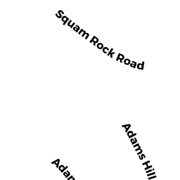
41 ADAMS HILL RD
Owner Information
GREENSTEIN DAVID
41 ADAMS HILL RD
GLOUCESTER, MA 01930


Property Details
41 ADAMS HILL RD is classified as a Single Family Residential (Colonial).
The primary structure on this property was built in 1920. There are 8673ft2 of built area within this property. There is 5209ft2 of residential/living space within this property.
41 ADAMS HILL RD is valued at 2115900. The land is valued at 901700 and the structures are valued at 1144200. There is an additional valuation of 70000 on this property.
This property is in Zone R-20. Confirm with local Zoning Board authorities to ensure there are no overlays or other easements on this property.
41 ADAMS HILL RD was last sold on 2021-06-18 for 3100000.
Assessment data from fiscal year 2022.
Flood Data
According to the FEMA National Flood Hazard Layer, this property does not appear to be in a flood zone. It may also be in an area not yet reviewed. Nonetheless, confirm this information prior to taking any action.
To view the flood hazards around this property, create a FEMA "Firmette" Map of the area around 41 ADAMS HILL RD.
Broadband Internet Providers
| Provider | Type | Bandwidth (mbps) | |
|---|---|---|---|
| Viasat Inc | Satellite | 100 | 3 |
| VSAT Systems, LLC. | Satellite | 2 | 1 |
| HughesNet | Satellite | 25 | 3 |
| Verizon New England Inc. | DSL | 5 | 0 |
| GCI Communication Corp. | Satellite | 0 | 0 |
| T-Mobile | Fixed Wireless | 25 | 3 |
| Comcast | Cable | 1000 | 35 |
Broadband service provider data from December 2020.
Adjacent Properties
- 47 ADAMS HILL RD
Single Family Residential owned by LANGER STEPHEN T & JANET C - 19 ADAMS HILL RD
Undevelopable Residential Land owned by RUSSO KAREN & LERNER JOHN - 10R SQUAM ROCK RD
Undevelopable Residential Land owned by GREENSTEIN DAVID - 21 ADAMS HILL RD
Undevelopable Residential Land owned by GREENSTEIN DAVID - 23 ADAMS HILL RD
Single Family Residential owned by PARKS BERNICE D - 25 ADAMS HILL RD
Single Family Residential owned by FAY MICHAEL F & GINER SILVANA A TRS - 43 ADAMS HILL RD
Single Family Residential owned by KENNEDY SARGENT & DEBORAH TRS ET AL